
What to know before you go
Lushoto is the district capital of Lushoto District, Tanga Region. It sits in the West Usambaras — part of the ancient Eastern Arc Mountains — at roughly 1,400 m above sea level. The main viewpoints and forest reserves sit higher, some above 2,000 m.
Don't confuse the West Usambaras with the East Usambaras. The West Usambaras (Lushoto, Magamba, Mtae) are what this guide covers. The East Usambaras (Amani Nature Reserve, Muheza District) are ~150 km southeast — a separate 3–4 hour drive with its own base town. Travel writers regularly muddle the two.
The town suits independent travellers, hikers, birders, and anyone who wants a cool-climate change of pace from a coastal or savanna trip. It does not suit visitors looking for a restaurant scene, warm swim weather, or fast internet.
The single most-common first-time mistake: underdressing. Locals wear jackets in the evenings year-round. Pack a fleece, warm socks, and a light waterproof — the morning mist is the real thing.
A short history: Wilhelmstal and the Shambaa Kingdom
Before the Germans, the Usambaras were the heart of the Shambaa Kingdom — an 18th–19th-century polity ruled by the Kilindi dynasty from the capital at Vuga, a short drive from modern Lushoto. Shambaa culture is still the living everyday culture of the mountain villages you'll walk through on a Lushoto trip.
In 1898 the German colonial administration founded Wilhelmstal at the site of present-day Lushoto, naming it after Kaiser Wilhelm II. For a brief period Wilhelmstal was seriously considered as the capital of German East Africa because of its cooler climate. That plan died, but the built infrastructure survived. Named buildings still standing today: the Lawns Hotel (guesthouse since ~1900), the German Lutheran mission church and mission compound, Irente Farm, the old District Commissioner's residence, and the Mombo–Lushoto cobblestone road with its original brick stream bridges.
How do you get to Lushoto?
Driving from Dar es Salaam (6–7 hours private, 7–9 hours by coach)
The standard route is the A14 Chalinze → Segera → Mombo, then the switchback climb up the Mombo–Lushoto road. Total distance ~400–410 km. A private vehicle does it in 6–7 h; direct coach in 7–9 h depending on Chalinze traffic. Coaches leave Ubungo Bus Terminal (Magufuli Bus Station) around 05:30–06:00 — Shabiby, Kimbinyika, Ibariki, Shambalai Express. Fare TZS 25,000–35,000 semi-luxury. Buy the ticket the day before at the ticket window — never from a stranger who approaches you on the morning of travel at Ubungo.
Driving from Arusha (5–6 hours private, 6–8 hours by coach)
Southeast on the B1/A23 to Same, then continue to Mombo and turn up the mountain road. ~300 km total. This is the natural approach if Lushoto is a post-safari decompression stop after Serengeti, Tarangire, or Ngorongoro.
From Moshi / Kilimanjaro International Airport (JRO)
~260 km. Private vehicle ~5 h via Same and Mombo. Useful if Lushoto is the first stop after landing.
The Mombo → Lushoto climb
Whichever direction you arrive from, the last leg is the same: a 33 km cobblestone-based road (originally German-engineered, later resurfaced) climbing the Usambara escarpment in switchbacks. 1.5–2 hours in a private vehicle. Dala-dalas, minibuses and boda-bodas run this leg all day for TZS 3,000–5,000 if you've arrived at Mombo by long-distance bus. Road condition is good tarmac in dry season; slippery in the long rains.
The hikes and viewpoints — which one to pick
| Trail / site | Distance / drive from Lushoto | Time | Difficulty | What you see |
|---|---|---|---|---|
| Irente Viewpoint | 7 km | 1.5–2 h each way on foot (or drop-off) | Easy | 1,000 m cliff drop to the Maasai Steppe |
| Magamba Nature Reserve | 8–15 km | Half to full day | Easy–moderate | Endemic chameleon, German bunker, forest birds |
| Mkuzi Waterfall | ~2 h drive to trailhead | 1 h forest walk | Easy | The only swimmable falls in the range |
| Mtae "World's View" | 55 km / 2.5–3 h drive | Overnight or multi-day trek | Moderate | Panorama over Mkomazi NP; Kilimanjaro on clear mornings |
| Lushoto → Mtae village-to-village trek | 60–82 km cumulative | 2–5 days | Moderate–demanding | Lukozi, Rangwi, Mtae villages; rainforest ridgelines |
Irente Viewpoint — the classic
The signature Lushoto site. From the escarpment edge the plains sit almost 1,000 m below and the horizon stretches to the Maasai Steppe. Foot-hike is about 1.5–2 h each way through Sambaa farms; a drop-off shortens it to a short walk. Gate fee is TZS 2,000 per person (confirm at the office — small local fees change without notice). Sunset is the photograph; go early in the day if you want the sharpest visibility before afternoon haze.
Magamba Nature Reserve — for the endemic wildlife
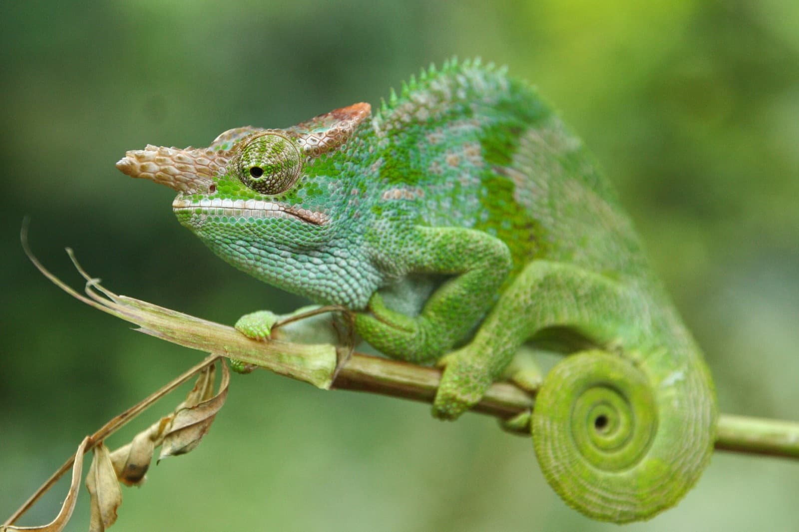
Tanzania Forest Services manages Magamba. It's the most accessible habitat for the West Usambara two-horned chameleon (Kinyongia multituberculata) — IUCN Endangered (2022 assessment), endemic to this range, found in Afromontane forest at 1,200–2,500 m. Also expect the Usambara akalat, Usambara weaver, silvery-cheeked hornbill, black-and-white colobus, and blue duiker. The reserve holds an old German WWI bunker on Magamba Peak that most guided hikes now include. TFS fee is not published — the reserve office (magamba@nature-reserves.go.tz, +255 627 003 273) is the source of truth.
Multi-day village-to-village hikes
The classic Usambara traverse is Lushoto → Lukozi → Rangwi → Mtae — 2 to 5 days on foot through Shambaa villages, small farms, and rainforest ridgelines, ending at Mtae's "World's View" over Mkomazi. Homestays and simple guesthouses along the route are arranged through Friends of Usambara Society (usambaratravels.com).
Wildlife and birding
Lushoto is not a big-game destination. The wildlife here is forest-scale: endemic chameleons and geckos in the Magamba understory, black-and-white colobus in the canopy, blue duiker on the trails, and roughly 350 bird species across the West Usambaras including several endemics (Usambara akalat, Usambara weaver, Usambara double-collared sunbird). For big-game, the natural pairing is Mkomazi National Park — visible from Mtae — or a full northern-circuit safari before Lushoto.
When to go — month by month
| Month | Weather | Trails | Notes |
|---|---|---|---|
| Jan | Warm, brief showers | Passable | Short dry window, fewer visitors |
| Feb | Warm, brief showers | Passable | Same as January |
| Mar | Rain building | Muddy | Avoid — long rains starting |
| Apr | Heavy rain (peak) | Poor | Avoid — trails closed in on high routes |
| May | Rain easing but wet | Muddy | Avoid |
| Jun | Cool, dry | Excellent | Best month for hiking clarity |
| Jul | Cool, dry, cold nights | Excellent | Peak season, book lodges ahead |
| Aug | Cool, dry, cold nights (~10 °C) | Excellent | Peak — coldest nights of the year |
| Sep | Cool, dry | Excellent | Peak, still quiet |
| Oct | Warmer, dry | Excellent | Underrated — comfortable temps, fewer tourists |
| Nov | Short rains | Mixed | Occasional dry days between showers |
| Dec | Warm, brief showers | Passable | Warmer window, mostly OK |
Best months: June to October for reliable trails and clear views. Avoid March to May.
Common mistakes
- Underdressing. Nights routinely hit 10 °C in June–August. Bring a fleece.
- Trying to do everything in one day. Rush Irente and leave and you'll miss what Lushoto actually is. Two nights minimum; three is better.
- Confusing Amani with Magamba. Amani Nature Reserve is in the East Usambaras (Muheza), a 3–4 hour drive south. It is not a day-trip from Lushoto. If your itinerary lists Amani for a Lushoto trip, it's wrong.
- Skipping the tourist information office. Friends of Usambara Society in Lushoto centre knows which trails are passable that week, which guides are reliable, and pricing. Fees are fair.
- Buying bus tickets from touts at Ubungo. Buy the day before at the ticket window.